Mt. Maya

Route No.4
❹ Tengu Road

Part of the Mt. Rokko Traverse, this is the last long ascent on the mountain trail from Suma.
The route offers hikers a sense of accomplishment, providing a view of the landscape beyond the rocky terrain.


History
Origin and History of the name of Tengu Road

The area around the summit of Mt. Maya was a Shugendo (mountain asceticism) site for monks. Tengu-iwa Rock, also known as Gyoja-iwa Rock, located at the summit of the mountain, began to be called Tengu-iwa after farmers at the foot of the mountain mistook the monks practicing there for tengu (long-nosed goblins). It is thus also believed that the trail leading to Nunobiki no Taki Waterfall and Ichigahara was named Tengu Road.
Spot
Highlights・Famous spots


Ichigahara
The stairs next to Sakurajaya lead visitors to Ichigahara.
The area bustles with people cooling off in the shade provided by the trees and playing in the water. It’s a relay point that leads to several mountain paths.

Rocky area
One of the best parts of the Tengu Road is the many rock-climbing spots along the way.
Climb carefully, making sure to maintain a three-point support. For stability in the rocky area on the way down, it’s best to walk while thinking about where the feet should be placed.
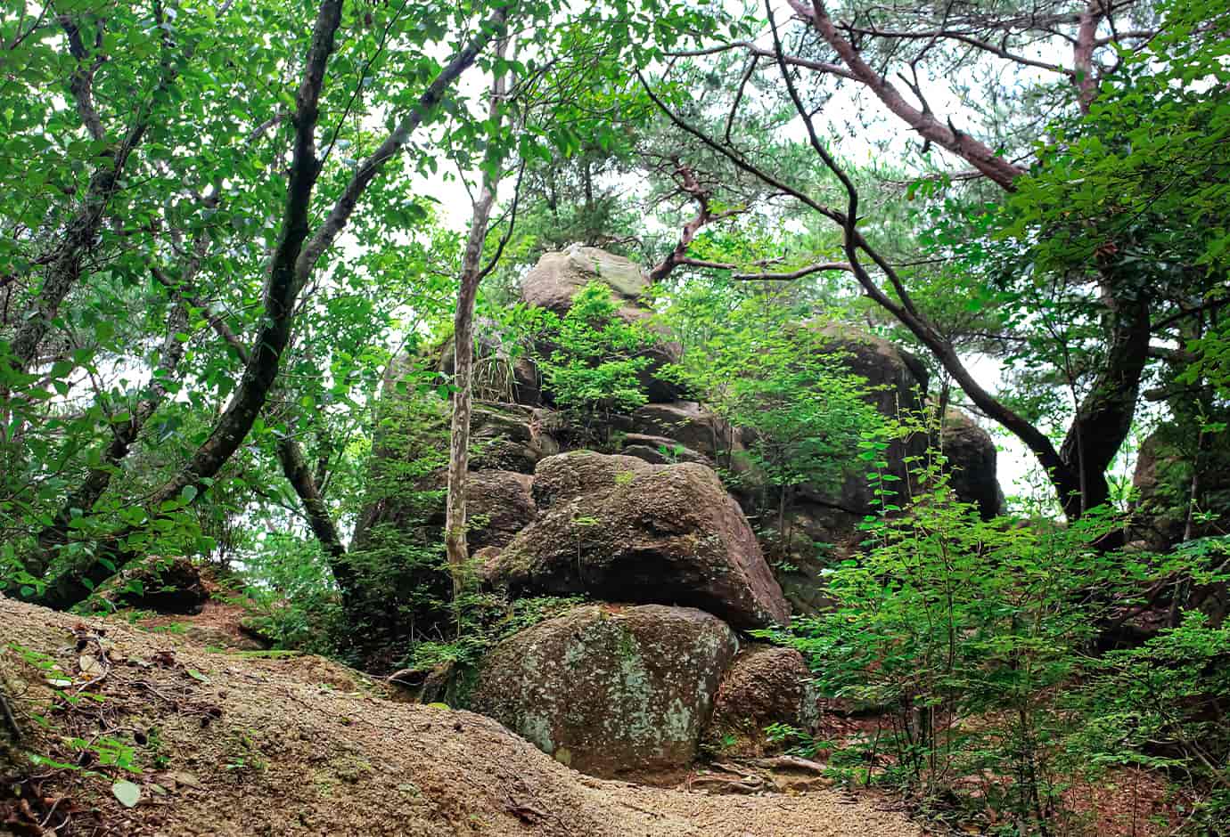
Scenic spot
There is a scenic spot just before the trail exit. A great view awaits behind the rock.

Tengu-iwa Rock
North of the summit of Mt. Maya, further in from the inner sanctuary of Tenjoji Temple, is Tengu-iwa Okami, giant rocks enshrined in the temple.
Behind the faded torii gate stands the Ishimaru Sarutahiko Okami monument, three rocks to which a sacred rope has been attached. One of these giant rocks is Tengu-iwa Rock, which is the size of about 8 tatami mats and is said to be the rock into which a monk from Mt. Maya sealed a Tengu (long-nosed goblin).
Please check out detailed information by using mountain maps or web applications
beforehand and enjoy your fun and safe hiking!


It takes about an hour from Shin-Kobe Station to the starting point!
Municipal Subway Sannomiya Station
On the way back, take the Maya Ropeway at Hoshi no Eki Station, Maya Viewline
https://koberope.jp/en/maya/price